- Over 200 IDPs in Ponnagyun struggle without shelter, food aid
- Junta airstrikes inflict deep psychological trauma on children in Arakan State
- Photo News: Over 200 IDPs in Ponnagyun in urgent need of shelter assistance
- Two children injured by UXO in Mrauk-U struggle to afford medical care
- High hepatitis cases hit children in Arakan State
Tidal erosion splits Taungup Twsp village in two
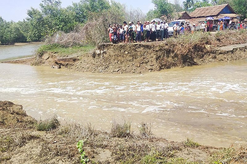
Ah Maw village on Pan Tin Island, which is located about 13 nautical miles west of Taungup town, has been hard-hit by erosion and was divided into two parts by tidal currents on the night of May 26, according to local residents.
28 May 2021

DMG Newsroom
28 May 2021, Taungup
Ah Maw village on Pan Tin Island, which is located about 13 nautical miles west of Taungup town, has been hard-hit by erosion and was divided into two parts by tidal currents on the night of May 26, according to local residents.
In the village of some 100 households, the road that connects east to west was damaged due to the tide and villagers are facing difficulties as a result, said Ko Chit Kyaw, a local from Pan Tin Island.
“About 100 people from more than 30 households are living in the west part of the village and the village’s cemetery is there too. The clinic and school are located in the east part of the village. So, villagers are facing difficulties going to the clinic, and students will also face difficulties going to school when schools are reopened,” he said.
The small creek that has emerged to essentially split the village in two requires that residents use small boats to pass through during high tide, and walk in knee-deep muddy waters at low tide, said Ah Maw villager Ma Nwe Nwe Than.
“It is not easy. We have to walk in mud even if the water level is low. I want authorities to make a causeway or a small bridge,” she said.
Ko Chit Kyaw advocated for building a retaining wall as a long-term solution to the erosion issues facing the island.
“This village is situated at the edge of the Bay of Bengal. So, it is hit by tidal currents whenever the tide is high. Maw Tin Creek in the village was located far away from the Bay of Bengal 20 years ago, but now the creek is located two or three miles away from it due to coastal erosion,” he said.
After the erosion occurred on May 26, township military council members and departmental officials checked the site the following afternoon.
Ko Htwee Khaing, deputy administrator of the Taungup Township military council, said they reported the situation to the district military council.
“We’ve conducted a field inspection. We’ve reported to the district [military council] to build a dam and dike to protect from erosion. We’ll carry it out according to superiors’ instructions regarding current transportation,” he said.
More than 5,000 people from 1,000 households in 12 villages live on Pan Tin Island. The 35-square-mile island is linked with the Bay of Bengal and grapples with high tide-related issues every year, residents said.
More than 200 temporary shelters at IDP camps in Arakan State were destroyed by high winds from Cyclone Yaas over the Bay of Bengal, and over 1,000 IDPs are facing difficulties as a result, according to IDP camp managers.


.jpg)