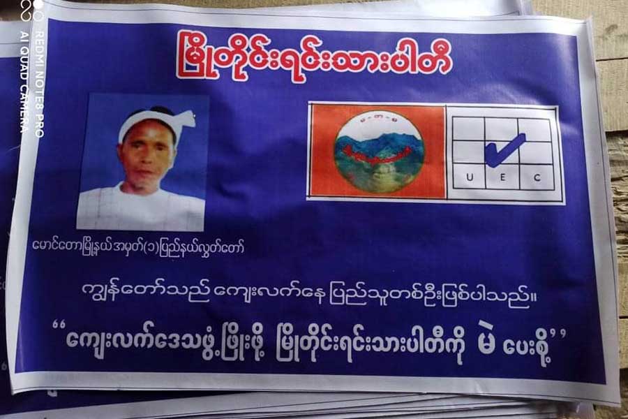
- A Glimpse Into the 2026 Arakan State Parliament
- Junta airstrikes target military outposts seized by Arakan Army in Arakan State
- Motorbike spare part prices skyrocket in Arakan State amid tighter traffic rules
- Kyauktaw IDP camps struggle with inadequate latrines
- Religious freedom, interfaith harmony expand in areas controlled by AA in Arakan State
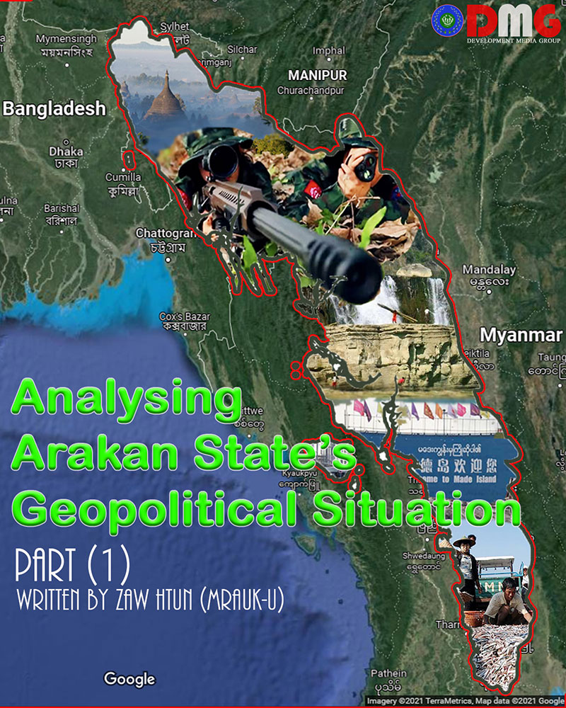
Analysing Arakan State’s Geopolitical Situation Part (1)
Singapore, with a population of about 5 million, and Israel, with a population of just over 9 million, have now reached a high level of productivity as the two countries worked hard to develop skilled labour and human resources. Smaller but more populous countries are being used as commodities to become big markets. Under the leadership of wise leaders, these small nations have successfully turned a geopolitical weakness of small populations into strengths and overcome them.
23 Oct 2021
Written by Zaw Htun (Mrauk-U)
The term “geopolitics” was coined by Swedish geographer and political scientist Rudolf Kjellén and has become very important in modern politics. The study of politics using geographic information is geopolitics. The geographical information of a country has great influence on the fate of that country, for good or bad. Kjellén simply described it as “combining geography with politics.” If we are going to study the geopolitics of a region, we must first study the geographical features of that region. The geopolitical strengths and weaknesses of Arakan State will be examined in detail from seven important geopolitical perspectives.
(1) Size
It can be said that size greatly influences a country’s power. Every country with a wide range of borders is influential For example, Russia, China and the United States are world powers. Not all small nations are powerful, but all of them are small in size. But that does not mean that every great country is good. The larger the border, the greater the military force, which can be costly. If there is instability in a country, there will be consequences such as the inability to maintain the border and the violation of sovereignty.
Whether Arakan is a confederation state or a new state, the importance of borders must be taken into account in pursuing their own interests. When it comes to the boundaries of Arakan State, the long stretch of land between the Arakan Mountains and the Bay of Bengal is not taken into account. The real Arakan territory was the territory given by the Burmese king to the British government under the Treaty of Yandabo after the First Anglo-Burmese War. At that time, Arakan State extended from the mouth of the Naf River to the mouth of the Maw Tin Zun on present-day Haigyi Island in Ayeyarwady Region and the present-day Paletwa area in Chin State. This means that it can only be fulfilled if the Arakan territory is the area specified in the Treaty of Yandabo. If we measure only from this coast to the sea, we cannot say that Arakan territory is small.
It should be understood that only the two land and water areas under the Treaty of Yandabo are truly Arakan territory. For an area as rich in natural resources as Arakan State, every inch is a precious gem. Reclaiming this territory, gaining control of the territory and securing territory will be the top priorities of the Arakan revolution and political movement. In the long run, long-term interests can be achieved by advocating for peace and coexistence based on historical evidence, rather than retaliation by force of arms. This means that it is best to focus on ways to achieve border stability.
However, the lessons of Myanmar’s political history can only be achieved with good heart and skill, so the future remains to be seen. Arakan State will be on the small list if it is divided into three categories: small, middle, and large. However, compared to other countries such as East Timor, Singapore, Israel, and Vatican City, Arakan State is still three or four times larger, so it is certainly not a very small area.
(2) Location
Although political systems can be shaped to suit national interests, the country’s location cannot be changed as needed. The location of a country has a profound effect on its political destiny, such as peace, instability, poverty, and development. The location of a country can be divided into three types: Landlocked, Open and Island, so Arakan State will be included in the Open category.
Since it is not a landlocked region, there will be few barriers, such as a permanent compromise in foreign policy formulation and a heavy reliance on another country for its own development. Arakan State, which has a long coastline, has the advantage of being able to build many ports and has strategic advantages not only with the Indo-Pacific but also with international connectivity. If the Kaladan River can be used to systematically access the Arakan coast, it will also contribute to the development of some landlocked townships in Chin State and inland states in northeastern India, such as Mizoram. It would be mutually beneficial, especially if there were joint ventures between Arakan and Chin states.
In addition, Arakan State is at the crossroads of Myanmar, Bangladesh and India, and is a strategic crossroads not only economically and politically, but militarily, as it connects land and sea to South and Southeast Asia. Although Arakan State is small in size, it has significant geopolitical advantages. But just because an idea is new does not mean it is bad. Since Arakan State is among countries many times stronger than it is, there is a risk that it will be hunted down and destroyed if there is no effective national unity and effective leadership and appropriate forces. Only the ability of the government to lead the people can be the answer.
(3) Shape of the State
The morphology of most countries can be divided into five main categories: compact, for example Poland in Central Europe; fragmented, for example Indonesia and the Philippines; elongated, for example Chile in South America; prorupted, for example Thailand in Southeast Asia; and complex, for example the United States. Arakan State, like Chile and Norway, is elongated. In elongated countries, poor national unity, poor communication links, and high levels of cross-border trade often lead to weak national unity and border instability. Vietnam, a long stretch of land alongside the South China Sea, has been plagued by sectarian tensions, while South Korea and North Korea have been divided.
Elongated Arakan State also has weaknesses in terms of national unity. Since Arakan territory was deliberately included in other areas of the country under the constitution, there may be mistrust among the Arakanese people and between the Arakanese people and the people of Ayeyarwady Region and Chin State. If we do not do “nation building” and “the state building” skillfully, we will face many difficulties in maintaining border stability. Without the systematic implementation of national unity plans as a priority, the shape of Arakan State could become geopolitically weak.
It would not be wrong to say that successive regimes have systematically manipulated the geopolitical weaknesses of centuries. These weaknesses can be transformed into geopolitical strengths through the strengthening of the border economy if the government that governs Arakan State has strong internal sovereignty and international recognition.
(4) Climate
Climate change is also an important geopolitical factor. Climate can be roughly divided into five types: tropical, dry, temperate, continental, and polar. Extremes of heat and cold can have a profound effect not only on the physical and mental condition of the people living in a country, but also on their socio-economic status. Countries prone to natural disasters, such as earthquakes, tsunamis and floods, will have to seek help from neighbouring countries and international humanitarian aid, and the climate will have a certain effect on a country’s foreign policy.
Arakan State is considered a tropical monsoon climate. The Arakan Mountains are also connected to the Sagaing Fault, so there is a need to be wary of earthquakes. Frequent floods have affected agriculture and the socio-economy, but in reality it is more due to the mismanagement of governments rather than floods.
If dams can be built to prevent millions of gallons of freshwater from being wasted into rivers flowing into saltwater seas, it could prevent the side effects of floods and accelerate hydropower and agriculture. While Arakan State has its own monsoon climate, it is a geopolitical advantage, but it is unfortunate that even its strengths have been weakened by the incompetence of successive governments.
(5) Topography
Topography is also very important for a country’s development and security. Topography includes hills, mountains, rivers, lakes, natural vegetation and plains. Depending on the terrain, agriculture and military strategies may change. Even the construction industry is influenced by topography.
Arakan State is topologically diverse, so it can be said that if you use it well, you will be able to become rich day by day.
(6) Demography
A census is an important means of learning a country’s total population, gender ratio, working population, income levels, unemployment rate and a number of other important measures of human resources. By looking at these statistics, we can know the current situation, such as the development and poverty of a country, as well as predict future development prospects. Thus, the pattern of population distribution also plays an important role in the study of geopolitics.
Countries with large populations are said to be more powerful, but there is a tendency for instability and conflict to occur when large populations are poor. What matters most in a population is how much workforce there is and how many professional human resources there are. In other words, there must be both quantity and quality. China, which accounts for about 19% of the world’s population, and India, which accounts for about 17% of the world’s population, are among the world’s largest powers today, but the United States and Russia, two times smaller in terms of skilled labor and human resources, are far behind.
An analysis of the world’s most powerful nations shows that most of the larger and more populous countries in the world are far ahead of others. Of these, countries with more skilled workers and more human resources are at the top. According to the 2014 census, Arakan State, which has a population of less than 4 million, is geographically weak in terms of population. Arakan State is also home to many of the interests of China, with its population of more than 1.4 billion. Therefore, from a demographic point of view, Arakan State is very worrying.
Arakan State is still very weak in terms of skilled labour and human resources compared to its neighbors. Therefore, it is very important for the government that leads Arakan State to manage this weakness and create strengths. The government that will lead Arakan State must prioritise the production of skilled labour and human resources as a priority. It must accelerate and transform itself into a producer society. If we can develop skilled workers and human resources in a short period of time and transform them into a productive society, then large neighbours of Arakan State can become the best markets. Most importantly, good leadership and leadership skills can turn weaknesses into strengths.
Singapore, with a population of about 5 million, and Israel, with a population of just over 9 million, have now reached a high level of productivity as the two countries worked hard to develop skilled labour and human resources. Smaller but more populous countries are being used as commodities to become big markets. Under the leadership of wise leaders, these small nations have successfully turned a geopolitical weakness of small populations into strengths and overcome them.
(7) Natural Resources
While not every country is rich in natural resources, natural resource ownership is one of the main causes of development. Natural resources are still valuable in their own right, and if they can only be added with technology, they will be more valuable. However, when natural resources are not in the hands of deserving ones, they can be turned into resource curses and drag on into a cycle of instability and violence.
Arakan is one of the most resource-rich states in Myanmar. There are at least three categories of resources in Arakan State: natural resources, colonial heritage, and cultural heritage. Natural resources in Arakan State include beaches, forests, bamboo forests, waterfalls and irrigation dams, freshwater rivers, streams, lakes, plains, oil and gas fields, paving stones, limestone and marble, iron ore, islands, coasts and ports. Colonial heritage includes lighthouses and railway buildings, and the rich cultural heritage from the Danyawadi period to the Mrauk-U period is rich in both tangible and intangible cultures. Resources and heritage in Arakan State can be further subdivided into resources for tourism, resource ports for the production of consumer goods, and resources for the construction of economic zones.
Beaches, waterfalls, evergreen forests, and colonial and cultural heritages can be used to boost tourism and create jobs for at least one-tenth of the Arakan population. By producing saltwater pearls and prawns from the seabed and using systematic production of vast plains, forests, irrigation canals, freshwater rivers and lakes and streams, it would not only be sufficient for a population of about 4 million people in Arakan State, but also for distribution to neighbouring countries such as India and Bangladesh, and even countries farther afield. It also has the potential to generate millions of dollars in foreign currency if only natural gas reserves off the coast of Arakan and oil wells on Ramree Island can be systematically extracted.
Marvelous stones, which are very useful in the manufacture of ornaments and consumer goods, are endless in the Arakan Mountains. Studies have shown the existence of other industrial raw materials in Arakan State including iron ore and limestone, as well as titanium. If more than a dozen waterfalls and irrigation dams are used to generate hydropower, it will be able to provide electricity not only to the whole of Arakan State, but also to Myanmar and other neighbouring countries. If only human resources and technology could be added to this wonderful gift of nature, Arakan State would be able to grow day by day.
However, while resources can be medicinal if you know how to use them, they can be just as catastrophic if you do not use them. There are many reasons why the region, which is so rich in resources, is as poor as it is now. No one can deny that greedy people are coming to Arakan land, which is full of precious resources, just as bees come to a flower. It is undeniable that the Mughal kings invaded Arakan State, which flourished in the 15th and 16th centuries, and was invaded by the Burmese and British because it was a valuable territory.
Even today, the Chinese have come to Arakan State from thousands of miles away because of huge natural gas reserves and access to the sea. Similarly, India under the Kaladan project, South Korea and its allies under the Korean port project, and Vietnam and its partners under the Nayputaung project are entering Arakan State in various forms.
According to Myanmar’s SEZ law, the government can designate any part of the country as a special economic zone. The Arakanese people do not agree with the project, but the government and the implementing company can reach an agreement if the two sides reach an agreement. The project is already showing signs of potential repercussions without the consent of the local people, the original owners of a resource. In fact, if a major project is to be implemented, the Social Impact Assessment (SIA) on the local population and the Environmental Impact Assessment (EIA) will be the responsibility of the responsible government and the implementing company. Surveys need to be conducted to solicit the views of local people, and the businesses to be implemented need to be responsible businesses.
Otherwise, protests against local projects will inevitably ensue. The Kyaukphyu-Kunming gas and oil pipeline project has lost a lot of local farmland and the deep-sea port project has severely affected local fisheries. The government also needs to make public the results of the projects. Each project must be transparent about how much revenue it receives and how much of that revenue is being spent on which projects, and how much is being allocated to the local population. The Shwe gas project in Kyaukphyu Township generates billions in annual revenue, but protests have erupted over where that money goes. Inevitably, the grievances of the Arakanese people will increase day by day. If such mismanagement continues, political tensions and resource grievances will inevitably merge and the tide of war will intensify.
If wars and unrest erupt only because of resource sharing, resource abundance can lead to conflict rather than development. It is important to note that Arakan State is also in a position to catch the resource curse, as conflicts over resources are called the Resource Curse. The resource-cursed region is underdeveloped as it is engulfed in a cycle of conflict, embroiled in civil war and miserable poverty. In short, Arakan State has many advantages from a geopolitical point of view, but it also has some weaknesses. For the 4 million Arakanese people in terms of land and water, it is possible to live with dignity in downtown Yangon as a landlord with large plots of land, but compared to other countries such as India and China, which can become business partners, there is only one of them.
Due to Arakan State’s location and the coexistence of different groups, it is important to prioritise border stability and national unity, and to have good organisational skills. From a climate point of view, Arakan State is prone to natural disasters such as floods, storms and earthquakes, so efforts must be made not only for prevention but also for good neighbours and good friends. From a geographical point of view, it must be said that Arakan State’s location is very good.
In terms of population, Arakan State has a geopolitical weakness. This is because Arakan State shares borders with highly populated Bangladesh and is in India and China’s backyards. In addition, the Arakanese people have very little skilled labour and human resources, so their dependence on foreigners will be a big measure. Therefore, human resource development must be made an urgent priority. From a resource perspective, the governments that will lead Arakan State will need to be extra vigilant about overcoming the resource curse. To overcome this, the government that governs Arakan State must be prudent in implementing the Social Impact Assessment (SIA), Environment Impact Assessment (EIA), fostering a responsible business climate and meeting the standards of the Extractive Industries Transparency Initiative (EITI).
Any geopolitical weakness can be turned into an advantage if the ruling government and the people are able to work together for the common good of Arakan State. Arakan’s Vesali period and the 15th century Mrauk-U era are not mere legends.


.jpg)
