
- Health concerns grow in flood-affected Minbya Twsp villages
- Arakan Army becomes largest revolutionary force in South and Southeast Asia, US research group says
- Myanmar-Russia military drill signals need for revolutionary forces to adapt: analysts
- Floods contaminate at least 20 drinking water ponds in Minbya
- Floods destroy small-scale livelihoods of Kyauktaw residents
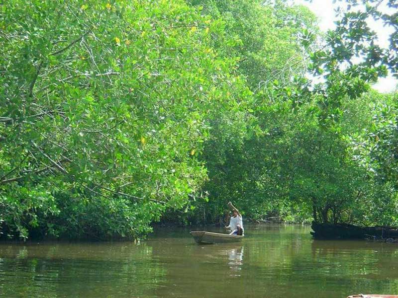
Arakan State's mangrove forests continue to shrink due to Chinese-backed projects
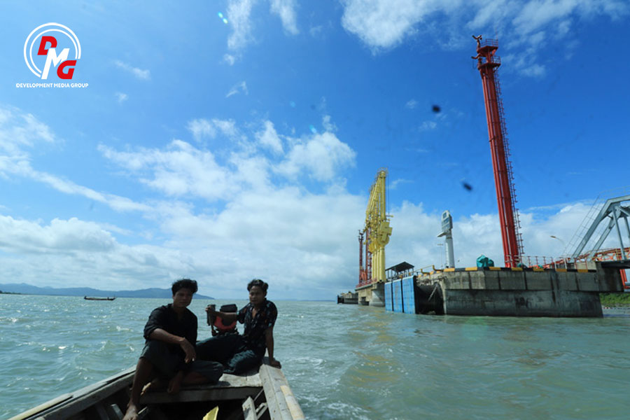
The junta banned local people from traveling in the waters around Maday Island for two-and-a-half months from July 15 to September 30 to carry out repair and dredging to allow large oil tankers to enter and exit the port on the island.
28 Sep 2024
By DMG
The sound of machines and cranes can be heard from the restricted area, which is fenced off by brick walls fortified with barbed wire that are twice the height of an average man. Ocean-going vessels are either docked or moving around in the nearby sea.
The restricted area is the site of a China-backed oil and gas pipeline project on Maday Island in Arakan State's Kyaukphyu Township.
"We have lost mangrove forests due to the negative impacts of this project. Water resources that thrive on mangrove swamps have been depleted. Who will compensate us for our loss?" U Kyaw Kyaw (pseudonym), a local fisherman in his 40s, questioned.
The mangrove forests on Maday Island and in 30 nearby villages have traditionally provided a livelihood for the local people, who rely on fishing for their income. However, over a decade ago, authorities began restricting access to the mangrove forests and nearby water bodies to make space for a Chinese project. As a result, the local residents lost their fishing grounds and the resources they depended on, such as fish, crabs, and mussels.
"We have not been able to fish and enter the mangrove forests since they started the project, and oil tankers started coming to the island," said U Kyaw Kyaw.
The junta banned local people from traveling in the waters around Maday Island for two-and-a-half months from July 15 to September 30 to carry out repair and dredging to allow large oil tankers to enter and exit the port on the island.
In Myokyaungkyun, Kyeinchaung, Thitpoketaung and other villages near the project, 90 percent of villagers are fishermen or rely on mangrove forests for their livelihoods. They said fish stocks have significantly declined since the start of the Chinese project.
According to the Arakan State Forest Department, the mangrove swamp coverage has declined from 183,660 acres to 132,405 acres in Kyaukphyu District between 2015 and 2020. Poverty rates have increased as a result, forcing many young people to search for better job opportunities and income in foreign countries.
"Young people no longer want to live in the village as they can make no money. They have left for Thailand, Malaysia, and China," said a woman from Maday Island.
Beneficiaries of the Chinese pipelines
The pipelines start in Maday Island and stretch as long as 771 kilometers through Arakan State, Magwe and Mandalay regions and Shan State before ending in Kunming in China's Yunnan Province.
According to the Institute for Strategy and Policy-Myanmar, the oil pipeline is designed to transmit up to 22 million tons per year. Currently, it is transmitting 16,000 tons of crude oil daily, while the gas pipeline is transmitting 400 million cubic feet of gas daily.
Myanmar received US$ 42.965 million from the gas pipeline, and US$ 64.174 million from the oil pipeline, totaling US$ 107 million in 2018-19, according to project reports.
The military regime has reportedly earned US$2.25 billion from the oil and gas sector in the two years following the 2021 coup, according to the Blood Money Campaign (BMC), an organization that advocates for financial isolation of the junta. This income has facilitated the development of the Kyaukphyu Special Economic Zone (SEZ) and the Kunming-Kyaukphyu railroad, both of which are part of the China-Myanmar Economic Corridor. In June, a group of Chinese diplomats visited Maday Island to conduct field surveys for the Kyaukphyu SEZ. The Chinese Embassy has urged the regime to safeguard these projects.
The Thanzit River flows from Maday Island to Ann and Myebon townships. Residents in Ann Township are also facing the negative impacts of oil and gas pipelines.
Ko Myo Maung, a resident of Linpankya village in Ann Township, has grown up catching crabs in mangrove forests. The 35-year-old crabber said the catch had significantly declined. Previously, when he set 60 crab traps, he would catch two to four crabs in each trap. However, these days, he barely gets 20 crabs with the same 60 traps.
"Previously, I got an average of three crabs in each trap. But, these days, nothing is caught in most traps," said Ko Myo Maung.
The projects have significantly affected the livelihoods of local fishermen. Fishing has been prohibited in large areas surrounding the project, leading to declines in fish stocks. As a result, many fishermen on Maday Island are compelled to give up their fishing activities, as they lack alternative skills to earn a living.
Reports of declining fish stocks have also emerged from various villages in Ann Township, including Kyaukmyaung, Yaykaungche, Chitponema, Sitaung, Amwepone, Kargyitaung, Thinecheinkan, Yinyepyin, and Peinnechan. Locals attribute this decline to the deforestation of mangrove forests and water pollution caused by the oil and gas pipeline.
Water Pollution in Thanzit River
In July and September of 2018, the water in the Thanzit River turned rusty, and as a result, thousands of marine mussels washed up in the river's inlets. Residents have reported a decline in fish, prawn, and crab stocks since then.
The Thanzit River is not only impacted by the deep-sea port but is also the main source of livelihood for hundreds of fishing households from Kyaukphyu town. Villages along the Thanzit River also rely on the river for their livelihoods.
One resident from Sitaunggyi village in Ann Township recounted to DMG that: "The catch has gone down since."
The environmental group Alarm Myanmar said in August of that year that contaminated water from the Thanzit River was found to have lead levels 10 times higher than normal, and phenol compounds 26 times higher than the standard level.
Locals suspect that oil tanks on Maday Island are causing water pollution in the Thanzit River and depleting fish stocks. However, the government did not explain the cause of the water pollution.
Instead, authorities opened a case against Ko Myo Lwin, an environmentalist and founder of Ann Regional China Pipeline Watch (ARCPW) who called on authorities to investigate the cause of water pollution and mass mussel deaths, under Section 68 (a) of the Telecommunications Law.
"Authorities did not explain what had caused water pollution in the Thanzit River. People still do not get an answer," said a local environmentalist from Ann.
Local environmentalists in Ann Township said China-backed oil and gas projects and oil tankers negatively affected water quality, resulting in economic losses for fishermen and people who rely on the mangrove swamp in Ann, Kyaukphyu and Myebon townships.
Ann Township had 66,890 acres of mangrove swamp in 2022, according to data from the township's forest department. Half of them are looked after by environmental groups and locals themselves.
Great green walls
In Myebon Township, located in Arakan State, the area between the Arakan Mountains and the Bay of Bengal is covered in lush green mangroves, often referred to as the great green walls. Myanmar, the largest country in mainland Southeast Asia, boasts a continuous coastline of almost 3000 km, stretching along the Bay of Bengal and Andaman Sea.
According to a 2010 report in the book "World Mangrove Atlas" authored by Mark Spalding, François Blasco, and Colin Field, Myanmar's mangroves cover 502,911 hectares (1,242,190 acres), accounting for 3.3% of the world's total. This ranks Myanmar third in Asia and seventh in the world for mangrove coverage.
According to the World Bank's Myanmar country environmental analysis 2018, between 1978 and 2011, Myanmar's mangroves decreased by 64.2 percent, an average of 3.1 percent per year.
"Mangroves protect many people living in coastal areas from natural disasters such as storms and floods. In the mangrove forest, the biodiversity of animals and water resources provide sustenance for the local people. Now the mangroves are slowly disappearing," said an environmentalist in Arakan State.
The Wunbaik reserve mangrove forest (WRMF), Asia's second-largest mangrove forest, covers more than 150,000 acres and is located in Arakan State's Ramree and Kyaukphyu townships where Chinese projects are located. The WRMF covers about 56,633 hectares and is rich in biodiversity. Locals say that conservation of the mangrove forest is not a priority, and deforestation is rampant.
Previously, mangrove trees were only cut for firewood. Nowadays, people are logging mangrove forests for commercial purposes, including making charcoal and bricks, with authorities failing to take effective action, say activists.
Annually, as many as 200 tonnes of mangrove trees are illegally logged from the Wunbaik mangrove forest reserve in Ramree Township, one of Asia's largest mangrove forests.
According to surveys from 2015 to 2020, while forested areas have expanded in neighbouring countries, Myanmar saw a decrease from 42.92 percent to 42.19 percent.
From 2015 to 2020, the differences in mangrove acreage by district were as follows: in Maungdaw District, the range was from 5,320 acres to 620 acres; in Sittwe District, it was from 7,463 acres to 5,840 acres; in Mrauk-U District, it was from 148,268 acres to 55,300 acres; in Kyaukphyu District, it was from 183,660 acres to 132,405 acres; and in Thandwe District, it was from 83,876 acres to 61,172 acres. These statistics were provided by the Arakan State Forest Department.
"Mangroves have been affected by human logging since the beginning, as well as by large-scale projects. In order to revive the mangroves in Arakan State, there is a need for effective laws and awareness and local protection and conservation more than ever," said an official from the Rakhine Coastal Region Conservation Association.
Environmental conservation efforts are increasingly limited by the practical realities of war and the instability it brings. Many people, including environmental activists, have fled their homes in recent months due to the armed conflict in Arakan State, and now lead lives where consideration of day-to-day survival is paramount to environmental concerns.
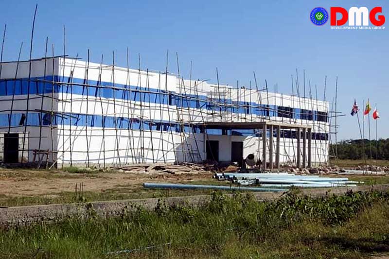
Kyaukphyu SEZ and environmental impact
In late August, Chinese Foreign Affairs Minister Wang Yi visited Nay Pyi Taw and met with junta leader Min Aung Hlaing. During the meeting, Wang Yi urged the junta chief to accelerate the development of the China-Myanmar Economic Corridor (CMEC) as part of the "Belt and Road Initiative," and to ensure the continued operation of the oil and natural gas pipeline.
Both parties are preparing to establish the Kyaukphyu SEZ as soon as possible. However, there is escalating military conflict in Arakan State, leading to occasional clashes between the military and AA in Kyaukphyu Township.
Nine out of 11 Chinese-backed projects in Arakan State have been partially controlled by the Arakkha Army (AA), according to the latest report from the Institute for Strategy and Policy Myanmar (ISP-Myanmar). According to the ISP-Myanmar report, the value of Chinese projects controlled by the AA is over US$2.3 billion, including projects that have not yet been implemented and whose value is unknown.
The AA has announced that it will welcome any foreign investment that contributes to regional development in Arakan State and will protect the safety of investors.
The regime wants to protect Kyaukphyu with its Chinese projects in order to maintain them, said U Tun Kyi, director of the Center for Peace and Development, which monitors Chinese-backed projects in Arakan State.
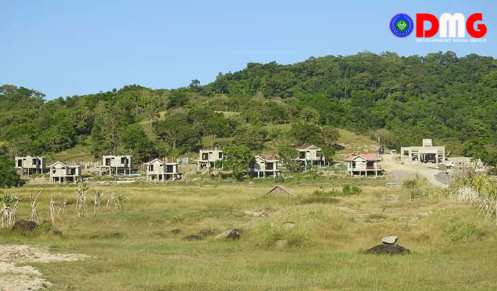
Kyaukphyu SEZ is a planned infrastructure project with three components: a deep-sea port (607.88 acres), an industrial park (2446.07 acres), and an integrated residential area (1235.37 acres). The deep-sea port will provide China with direct access to the Indian Ocean, allowing Chinese trade to bypass the congested Strait of Malacca while boosting development in its landlocked Yunnan Province, which borders Myanmar.
However, that project area also includes farmland, cropland, pastures and bodies of water in nine village-tracts in Kyaukphyu and Ramree Island.
"Locals can see that no matter how many environmental impact assessments China does, it cannot improve Myanmar's situation. Chinese-backed projects cause environmental damage," said U Aung Hsan, a local man in Kyaukphyu who monitors Chinese projects in Arakan State.
The regime has already approved the construction of two large reservoirs in Maday Island for the Kyaukphyu SEZ at a cost of over K40 billion or around $1 million USD, said a former lawmaker.
"Kyaukphyu is currently controlled by the military and the AA. On Maday Island, the Chinese and Myanmar authorities are carrying out repair and dredging to allow large oil tankers to enter and exit the port on the island, so local people are unable to catch fish and social health is still being affected," said U Tun Tun Oo, an Arakanese politician from Ramree.
The residents of Kyaukphyu are concerned that the construction of large Chinese projects may have a negative impact on the Great Green Wall. These mangroves are crucial for supporting the livelihood of coastal residents and preserving the Thanzit River, and there is worry that they may be lost.
"Chinese projects have also destroyed mangroves and lost fish resources in Arakan State. If the Kyaukphyu SEZ is implemented, the suffering of local residents will increase," said U Kyaw Kyaw.

Opinion

Reflections on the Arakanese (Rakhine) Language Curriculum
By Admin 14 Jul 2026
Holding On to Arakan
By Admin 26 Jun 2026
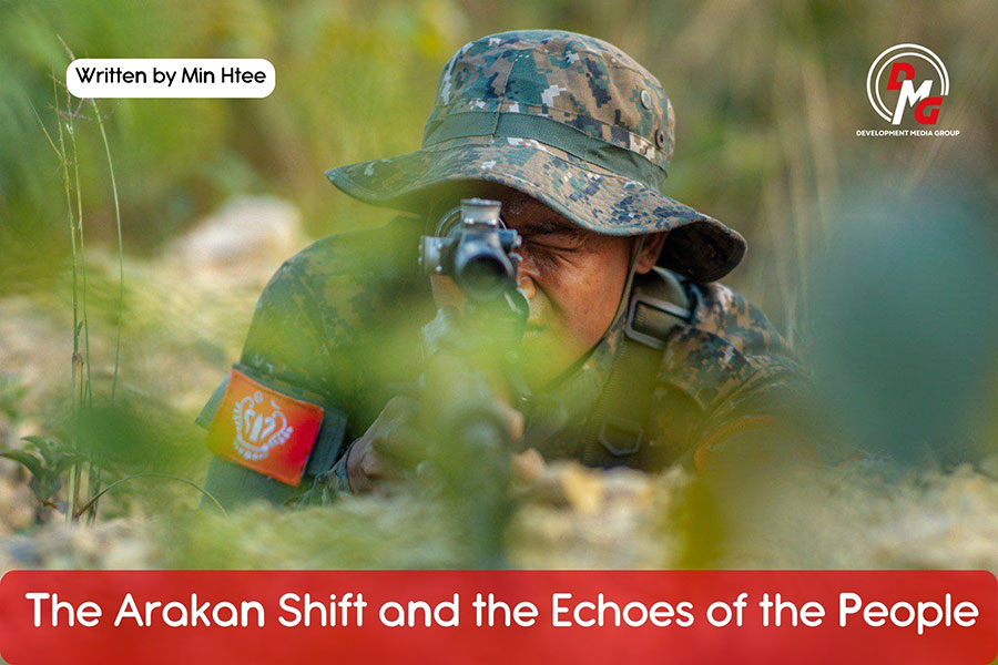
The Arakan Shift and the Echoes of the People
By Admin 13 May 2026

We Must Remove What Is No Longer Needed
By Admin 24 Apr 2026
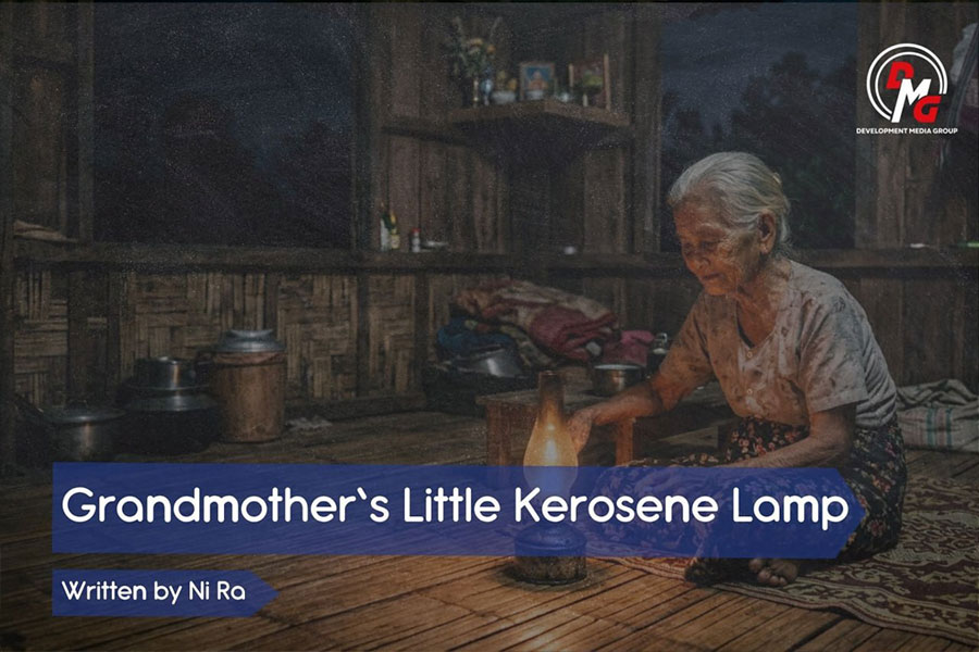
Grandmother’s Little Kerosene Lamp
By Admin 08 Apr 2026

Bangladesh’s New Foreign Policy Gamble and the Arakan Puzzle
By Admin 06 Apr 2026
POLITICS


BUSINESS
Industry to manufacture finished goods from coconut starting in early 2020
By Aung Kaung Zaw 20 Nov 2019